Get Forecast For:
Lawrenceville Weather

A Short Summer Ahead?

Tuesday, April 21st, 2009

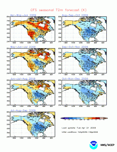
Wednesday is slated to be the last day of the relatively cooler than normal temperatures we have seen for the first three weeks of April. CFS Temperature ForecastTemperatures will rise to the upper 70s, and will reach the 80s by the weekend. It’s likely to stay warmer than normal for the next few weeks, as the first real Bermuda High takes control over the southeastern United States.

In the long run, though, May could be the warmest month through the end of the summer, relative to normal. The image at right shows the latest modeling by the CFS, or coupled forecast system. (Click to enlarge the map). It shows temperatures becoming steadily cooler after a slightly warmer than normal May in the Southeast, and much cooler than normal for the eastern half of the country in July, August and September
CFS Forecast Trend through December, 2009The trend through the end of the year points to colder than normal weather as well, as can be seen by the second graph, which shows forecast temperature anomalies by three month period through the end of the year, by which time virtually the entire country, except for the San Francisco Bay area and much of New England should be cooler than normal.

Tornado Reports

Numerous confirmed tornadoes stuck north and central Georgia over the last ten days. On Friday, April 10th, twelve confirmed tornadoes and two suspected tornadoes touched down, with the bulk of them stretching from Columbus, through Americus and Cordele. Additional touchdowns were reported in Jasper and Sparta.

Then on April 19th, there were two more tornadoes, one again in the Columbus area, and the other in Cherokee County. Only one injury was reported in the April 10th incident, and two injuries were reported in the April 19th incident.

Sphere: Related Content

Share

Georgia Drought Could Persist Into Winter and Beyond

Thursday, October 16th, 2008

I know it’s not the headline that most people want, but the latest outlook from the Climate Prediction Center doesn’t show much relief for the drought that has been plaguing north Georgia for the last two years.

The 3 month outlook for November-January indicates at least a 33% chance of less than normal precipitation for all of Georgia, and a 40% chance of drier than normal conditions for middle and south Georgia. This is backed up by the CFS forecast, which shows below normal rainfall continuing for much of the next year(!). The CFS forecast also indicates a colder than normal start to the winter season, with November and December being cold, and the first few months of 2009 being warmer than normal.

The newly published drought outlook says,

In the Southeast, streams from northern Georgia to southwestern Virginia rapidly receded following heavy rains during the first half of October. The lack of sustained recovery in stream flows reflects the intensity and duration of the long-term drought. The seasonal forecast indicates that the drought will be ongoing for the next several months, but some additional improvement is expected during the second half of October, if not beyond. In contrast, with the official November-January outlook indicating the odds tilting toward below-normal rainfall south and east of the Tennessee Valley, the drought outlook shows little change in conditions for central and southern parts of Georgia and South Carolina, and even a good chance for drought expansion into Florida.

If there’s any good news in all this, there seems to be a good chance for above normal precipitation in both the 6-10 and 10-14 day outlooks, and the outlook for November is neutral. We are likely to get about half an inch of rainfall as the front passes through on Friday. That will bring us closer to ‘normal’ rainfall for October of 3.11 inches, but I wish it were a bit more evenly spread out.

Sphere: Related Content

Share

Rainfall Still Lagging, but Drought Improving

Saturday, March 15th, 2008

I got a comment from Matt asking how we’re doing with the drought, given the recent rainfall, and rather than answering his question in another comment, I decided to do a new post.

In reality, with 9.79 inches of Atlanta is still behind what would be ‘normal’ rainfall by 2.44 inches as of yesterday, and some of that deficit has been reduced by today’s storms.  However, we are doing better than as of this time last year.  In 2007, Atlanta had recorded only 7.71 inches by March 14th, 2.08 inches less than in 2008.  In Gainesville, which has had 10.74 inches of rain so far, they are ahead by 2.17 inches.  Here in Lawrenceville, I’m only showing .86 inches more rain than this time last year, but keep in mind I don’t have an ‘official’ rain gauge.

Even though actual rainfall varies across the metro area, it’s probably safe to say that we’re two inches ahead of where we were this time last year.  Plus, in 2007, the second half of March ended up being rain-free, so by the end of this month, we are likely to be even further ahead of 2007.

(more…)

Sphere: Related Content

Share

Rainfall Critical to Breaking Southeast Drought Before Summer 2008

Saturday, December 22nd, 2007

With both Atlanta and Athens, Georgia on track to record their driest years ever, it’s becoming ever more important that the area receives sufficient rainfall during the winter months. Continued lack of precipitation could mean that drought conditions in 2008 will be worse than in 2007.

Georgia State Climatologist David Stooksbury writes that while recent rains have helped some in increasing groundwater and stream flows, it’s by no means a break in the drought.

(more…)

Sphere: Related Content

Share

One More Week of Warm Weather – But the Real Cold May Be in February

Thursday, December 14th, 2006

I hope you’ve had a chance go go out and enjoy the warmer than normal temperatures we’ve had this week. We’ve seen temperatures about ten degrees above normal, and it looks like temperatures could get into the low 70s over the weekend.

Of course, it can’t go on forever. The pattern is likely to change a week from now, after a good chance of rainy weather midweek next week. After that, look for temperatures approaching normal to slightly below normal through the end of the year.

If you want to get a peek at what we could see for the rest of the winter, check out this graphic. It shows the expected deviations from normal for temperatures for the next six months, based on the CFS climate modeling system developed by the National Weather Service.

The models show a colder than normal December in Georgia–we are running about 3 degrees cooler than normal this month– followed by a normal to slightly cooler than normal January, a better chance for a cold February, a normal March, and a cold April. While these aren’t official forecasts, they do give some indications of what models say we’ll see this winter.

Even though the winter solstice is one week away, today was the first day since last July that the sun set later in the day than it did yesterday. Although we’ll see later sunrises for another three weeks, we’ll gain about ten minutes of evening light between now and the first of the year.

Sphere: Related Content

Share