Get Forecast For:
Lawrenceville Weather

Archive for the ‘Tropics 2007’ Category

Mea Culpa – But Still a Chance to be Atlanta’s Second Driest Year Ever

Saturday, December 29th, 2007

Back on Christmas, I posted that 2007 was not going to be the driest year ever recorded in Atlanta, given the Christmas rains. I also quoted the record as having been set in 1931.  Well, reviewing my sources, I found I was half right.  The 1931 amount was for rain through December 12th, not December 31st. They must have had more than two inches of rain in the last three weeks of December that year, because the actual record for the entire year is held by 1954, with 31.8 inches of rainfall.

With the good soaking we got on Friday, Atlanta’s rainfall total now stands at 30.55 inches for the year, or 1.26 fewer inches than the record amount of 1954.  There’s a reasonable chance that we’ll see that much tonight and tomorrow, but it really depends on where the bulk of the precipitation falls. Right now, a surface front lies across Georgia from southwest to northeast.  The exact position of the front will determine the amount of rainfall we see, but the HPC is calling for a band of two inch rainfall roughly between Columbus and Greenville, SC.  It may very well be that since Atlanta’s official rain gauge is at Hartsfield Airport on the southside, where more rain is expected, the record will be avoided.

In any case, the rain is welcome, although it’s going to be followed by colder weather to usher in the new year. Look for temperatures in the low 20s Wednesday morning, and highs only in the 40s on Wednesday.  By Thursday, we start returning to more normal temperatures, and even above normal temperatures for the first two weeks of the new year, with high temperatures reaching into the 60s, 15 degrees above normal. Lows should be in the 40s, also well above what we would expect to see in early January.

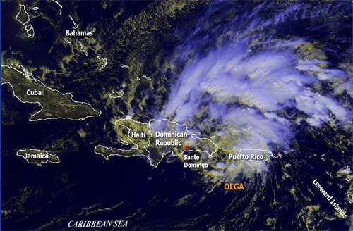
Meanwhile, tropical weather may be getting ready to make a late season appearance.  The National Hurricane Center is reporting that a low pressure system 950 miles southwest of the Azores is developing tropical characteristics, and could become a subtropical storm by Sunday morning.  We already had  Subtropical Storm Olga make a late appearance in mid December, so something is not out of the question.

Sphere: Related Content

Share

Indian Summer: Record Temperatures and a Tropical Storm

Tuesday, December 11th, 2007

As much of the southeast US enjoys record setting temperatures in December, maybe it’s only appropriate that a late subtropical storm make an appearance in the Caribbean Sea.  Subtropical Storm Olga is being tracked by the National Hurricane Center, and is making landfall over the Dominican Republic:

Subtropical Storm Olga

Don’t expect any drought relief from Olga, though.  Although she could drop up to a foot of rain over Santo Domingo, by Wednesday afternoon the storm will have become a tropical depression, and the remnant low will be over the Yucatan peninsula by the weekend.

Meanwhile, metro Atlanta is enjoying its third straight day of record warmth.  With the temperature already at 75 degrees, we’ve broken the old record for December 11th of 73, set back in 1985.  Yesterday’s high of 77 degrees broke the old record of 74, which was set in 1972, and Sunday’s high of 76 topped the previous record of 71 degrees in 1978.

Look for more warm temperatures through Thursday, when the high pressure system holding off the storms to the north will start to break down and bring in at least some rain.  By the weekend, it will feel more like winter, with highs in the upper 40s to low 50s.

Sphere: Related Content

Share

2007 Hurricane Season: Normal, but Less Than Predicted

Tuesday, November 27th, 2007

While the 2007 hurricane season doesn’t officially end until Friday, for all intents and purposes it’s over, with no activity since the beginning of November, and nothing on the horizon.  Despite predictions for an active season, 2007 ended up being about normal.  Dr. Gray and the gang over at the Department of Atmospheric Science at Colorado State University have released their 2007 summary (PDF) with the numbers for the season:

We had 14 named storms, with six hurricanes and two intense hurricanes this year. Dean and Felix ended up as category 5 storms, and both ended up on the Yucatan peninsula in Mexico.  The remaining hurricanes were category 1, or relatively minor.  For the second consecutive year, the United States went relatively unscathed, with only Hurricane Humberto striking Texas creating any significant damage.  Tropical Storm Barry brought some drought relief to parts of Georgia, and helped put out the south Georgia wildfires.  However, a storm that might have put a significant dent in the drought did not appear.

The Colorado State team seems to be at a loss to explain the weaker than expected season.  Some of the factors that would point to a stronger season, including the development of La Nina conditions and a relative lack of vertical wind shear worked out as expected.  Atlantic sea surface temperatures were slightly cooler than predicted, but this should not have been a major factor.

While the first half of the season turned out to be relatively normal, less than normal activity in October and November counted for most of the shortfall from the earlier projections.   And, the report said that despite normal to lower-than-normal hurricane seasons in 2006 and 2007, we are still in a period of greater than normal hurricane activity that will last another ten to 20 years.  This long cycle is part of the Atlantic Multidecadal Oscillation that is also responsible for the southeast’s rainfall shortage.

As far as what 2008 will bring…well, Dr. Gray’s team plans to issue its first 2008 hurricane forecast on December 7th.

Sphere: Related Content

Share

Tropical Storm Noel Forms South of Cuba

Sunday, October 28th, 2007

The low pressure system south of Haiti was upgraded to a tropical depression last evening, and this afternoon, was upgraded to a tropical storm.  Noel (pronounced Nole, by the way, not like the Christmas synonym) is presently 125 miles south of Haiti, and is headed towards Cuba.

Forecasters expect Noel to move northwest, and cross Cuba sometime Tuesday morning.  While the official forecast calls for winds to remain in the tropical storm range for the next few days, it’s not out of the question that it could intensify into a hurricane, either before or after crossing Cuba.

The ultimate path is still uncertain, and it’s possible that the storm could bring some rainfall to Georgia. It’s worth keeping an eye on.

Another thing worth keeping an eye on is the nighttime low temperatures over the next few days.  The Weather Service has issued a special weather statement advising of the possibility of frost tonight in the Georgia mountains tonight, and a better possibility of frost all the way south to a La Grange – Thomaston  – Warrenton line on Monday night.

The cold blast is bringing a freeze to Southern Ohio, West Virginia, and parts of Virginia tonight, and slightly further south Monday night.  If the cold weather doesn’t get here Monday night, there’s a chance coming again next week, so it’s probably a good time to get the house plants inside.

Sphere: Related Content

Share

Fall Comes In With Above Normal Temperatures

Sunday, September 23rd, 2007

Today is the first day of Autumn, but you wouldn’t know it by looking at the temperature. An upper level ridge in the northeast will bring ten degree above normal temperatures to most of the eastern half of the US through the end of the month. This, combined with high dew points in the upper 60s to low 70s makes the weather in Georgia more like August, rather than late September.

After much anticipation, the tropical disturbance that caused concern for the Gulf Coast last week turned out to be no big deal. Tropical Depression Ten lasted less than a day, and never developed winds greater than 35 MPH. It is, however, bringing rain to some areas in the southeast that need it, however not North Georgia.

In the Atlantic, Subtropical Storm Jerry has developed in the Atlantic, but isn’t going to affect the United States. Forecasters are watching several other developing systems, including this one:

Invest 94L

This low pressure area could develop into a tropical system affecting the gulf. Another low pressure system to the east of the Windward Islands could also become better organized in the next few days, and develop into a storm.

The map above, by the way was created by an updated version of the application I’m using to create the images and other information in the Tropical Center. It’s in final testing, and should go live within the next few days.

Sphere: Related Content

Share