Archive for the ‘Scorecards’ Category

August Was Hot (But You Already Knew That)

Saturday, September 1st, 2007

August was a record-breaking month in Georgia. In Atlanta, the first 26 days of the month had high temperatures above 90 degrees, and there were nine days where the temperature went above 100, tying a record set in 1980 for the most days in a year with temperatures above 100 degrees. For the month, the average temperature was 85.6 degrees, 6.7 degrees above normal. The high temperature of 104, set on August 23rd, was not only the record-breaker for the day, but for the entire month. You would have to go back to 1980 to see temperatures this warm.

Here in Lawrenceville, the average temperature for August was only 81.3, and the warmest day was the 9th, when the temperature reached 101.5. That’s still warmer then normal. One reason the average temperature was cooler than in Atlanta is that on many days, the overnight low temperature stayed lower than in the city. I recorded six days with overnight lows less than 70, while Atlanta recorded none. In Gainesville, the average temperature was 84.6, 7.1 degrees above normal, and in Athens, the average was 85.2, 6.9 degrees above normal August temperatures in the Classic City.

Believe it or not, but the official precipitation records for August 2007 in Atlanta will show the city received 95% of its normal rainfall of 3.67 inches. 3.48 inches of rain was recorded at Hartsfield-Jackson Airport during the month, but over two inches of that occurred in the last four days of the month, and most of the rest during the last week. Because August rainfall is typically driven by thunderstorms, the amount of rain you got depended on where you were. I recorded a scant 1.52 inches during the month, while Athens recorded less than half its normal monthly total, with 1.72 inches. Gainesville had 3.17 inches of rain during August.

September is a month of rapid change climate-wise, as we begin to see shorter days and lower daytime and evening temperatures. This month, however, is likely to be warmer than normal, with the Climate Prediction Center calling for at least a 33% chance of a warm September, and an even greater likelihood of hot weather for the southeast corner of the state.

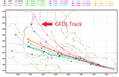
Things are busy in the tropics, by the way, with three active named storms. In the Eastern Pacific basin, Gil is beginning to lose strength, while Henriette is expected to gain strength, and eventually bring wet weather to the southwest US. In the Atlantic, Felix became a named storm this morning. He looks like he is going to follow roughly the same path as Dean did, but track slightly to the south.

Sphere: Related Content

Hurricane Dean Develops into Category 3 Storm

Friday, August 17th, 2007

Hurricane Dean has been intensifying over the past few days, and is now a Category 3 storm, with winds of 125 MPH, and a very distinct eye. By Sunday afternoon, he should be directly over the island of Jamaica, and just approaching being a Category 5 storm. A hurricane watch is out for the island.

The map above shows the a number of forecast tracks for where Dean will go after passing south of Cuba. While the consensus forecast is to keep the storm on a westerly track, notice the forecast of the GFDL model, which moves the storm northwest, and towards Louisiana. While this forecast is an outlier, the GFDL model has a tendency to be accurate, and the National Hurricane Center has noted this in its discussion, which assumes that the high pressure ridge over the southeastern US will keep Dean to the south. It will be early next week before the situation becomes clearer, but it appears this storm will be one to keep an eye on.

Meanwhile, here in Atlanta, my front yard looks like it’s the first week of October, rather than the third week of August. The almost complete lack of rainfall since the first of the month has brought the effects of the drought back with full intensity, and the dogwood and tulip trees are showing the strain by dropping their leaves.

While there are some storms in the area this evening, August has rapidly taken away any improvement we saw in our cooler, wetter July. The good news is that from this time next week through the end of the month, there’s a better than normal chance of rainfall, and this trend has been holding for the last two or three outlooks.

Meanwhile, the National Climate Data Center issued its temperature and precipitation summary for July. Georgia ended up with cooler than normal temperatures (30th coldest of 113 years), and near normal precipitation (45th driest out of 113 years). Montana, Idaho, and Wyoming had their warmest months ever, while Texas and Louisiana had their third wettest July ever.

Sphere: Related Content

June Weather Scorecard, and a Look at July

Monday, July 2nd, 2007

With the Dog Days of summer ready to begin tomorrow, it’s time to take a look at what we had in June, and what to look forward to as the hottest part of the summer begins.

June actually ended up having close to normal rainfall in Georgia, largely because of the effects of Tropical Storm Barry in the southeastern part of the state. Up here in North Georgia, Atlanta was just about at normal June rainfall with 3.66 inches of rain. With 4.7 inches, Columbus had more than an inch of above-normal rain. Macon saw 4.69 inches of rain, or 1.15 inches more than normal. Athens continued its deficit, with 2.17 inches, or 1.77 inches below normal. And finally here in South Gwinnett, my rain gauge recorded 5.03 inches, including over two inches from the thunderstorms that rolled through on June 28th.

The map above shows total estimated rainfall for Georgia in June. Areas in green and yellow, including most of the northwest part of the state, were short of rain.

The month ended up being warmer than normal for most of the state Mean temperatures include Atlanta at 79.5 degrees, 2.7 degrees above normal; Gainesville at 77.9 degrees, or 3.3 degrees above normal, and Athens at 78.5, 2.2 degrees above normal. Here in Lawrenceville, I was at the low end of the scale, at 76.5 degrees mean for the month. Part of the reason for that may be that I had more rain than normal, which tends to keep things a bit cooler.

July is likely to be warmer than normal as well, with the Weather Service estimating a 40% chance of above normal temperatures for all but the southernmost portions of Georgia. It may be that most of that heat will be towards the second half of the month, though, with the medium range outlook from the 8th to the 16th calling for normal to below normal temperatures.

On the rainfall side, the Weather Service doesn’t make a firm call one way or another, however it looks like we’re likely to see continued wet weather in the short term, or until the massive storm that is flooding much of Texas and Oklahoma finally goes away.

Today was the first time since July 10th, 2005 that a day in July didn’t go above 80 degrees (at least in my records). While the clouds kept the temperatures down, the main reason for the cooler weather is a phenomenon we normally see in the wintertime: cold air damming, otherwise known as the wedge. High pressure air in the mid-Atlantic states flows down the side of the Appalachian mountains, while low pressure air moves in from the southwest. Because high pressure air is heavier than low pressure, it becomes trapped underneath the low pressure system, and keeps the temperatures down (and the humidity up).

The good news is that the drier air will be moving in over the next few days, and we will, with any luck, have very nice, cooler than normal weather for Independence Day.

Sphere: Related Content

Georgia’s Driest May Ever in 2007

Sunday, June 10th, 2007

The temperature and precipitation rankings for May, 2007 are out, and they show that the month had the least Georgia May rainfall in 113 years of recordkeeping. The period from January to May ranked second for the least precipitation in both Georgia and Tennessee, and was the driest first five months ever in Mississippi and Alabama. The year between June, 2006–when the drought is considered to have begun– and May 2007 was the fourth driest June-May period recorded in Georgia.

May, 2007 Precipitation Ranks

It was also modestly dry across the country, with a national ranking of the 42nd driest May ever. The dry weather in the East was counterbalanced with wetter than normal conditions in the Plains states. As far as temperature goes, it was much above normal nationwide, with the 11th warmest May recorded. Most of the warmer than usual temperatures were in the North, while the South remained close to normal.

May, 2007 Temperature Ranks

Much of the western part of Georgia got some relief from the drought on Friday, as thunderstorms rolled through the area, although not much. I was lucky enough to get 2/3 of an inch (albeit in half an hour), but many areas, including the reporting station at Hartsfield Airport got less than half an inch. We’ve got a reasonable chance of getting at least some rainfall during the early part of the week, as a storm system currently over Arkansas comes our way on Monday. There’s also a chance of rain later in the week, as well. While there’s no tropical activity on the near horizon to stir things up, there is also a reasonable chance of a wetter than average week for the week of the 17th.

Sphere: Related Content

February Comes In Like a Lion, Out Like a Lamb

Monday, February 26th, 2007

Well, the saying above is supposed to apply to March, not February, but at least for this year, it works for me.

For 14 of the first 18 days of February, the mean temperature recorded was below 40 degrees. This is during a period when mean temperatures should be between 42 and 45 degrees. Then, as if by magic, the weather turned, and since the 21st, the mean temperature hasn’t gone below 50 degrees, and in the last few days, high temperatures have been about ten degrees above normal.

Essentially, a change in the upper air pattern from a trough over the eastern part of the country to a west to east zonal flow made all the difference in the world. Overall, February will go down as colder than normal by slightly over one degree, and will end up being colder than what we saw in January. Across the country, February is likely to go down as one of the top five coldest on record, but we’ll have to wait until the middle of next month for the final stats to be tallied.

What continues to be a concern is the lack of rainfall. With a total of 5.65 inches year to date in Lawrenceville, and 6.8 inches in Atlanta, we’re about 3 inches short of where we should be for the year. The Weather Service has classified North Georgia as ‘abnormally dry’ in its latest drought report, and doesn’t see any improvement in its drought outlook.

We may, however, see a bit of lion in the first few days of March. An approaching front will pass through on the first that could bring some thunder to the area, and over an inch of rain. Beyond that, we could see more precipitation over the weekend, although at this point, the chances are slim.

Sphere: Related Content