Archive for the ‘Winter 2005-06’ Category

Models Look Optimistic For Warmer Weather After Mid-Month

Tuesday, February 7th, 2006

Signs are beginning to point towards the cold wave we’ve seen since late last week ending by President’s Day. Since the beginning of the month, upper air patterns have allowed colder Canadian air to infiltrate the Southeast, bringing an end to the warmer than normal weather we saw in January. The primary culprit has been a trough of low pressure over the Eastern seaboard.

Essentially, this is the opposite of what we had in January, when a ridge over the east coast kept temperatures warm. So far in February, we are 3.6 degrees colder, on average, than we were last month, although that’s still 1.7 degrees above normal.

Forecast models are predicting that the trough will move out by February 17th or so, allowing warmer Gulf Coast air to come back in, and raise afternoon temperatures back into the 60 degree range, and keep overnight lows above freezing. In addition, it looks like the Arctic Oscillation is moving towards the positive configuration we saw for most of January.

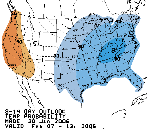
Of course, the models initially predicted that we would have the current cold spell sometime in late January, rather than what actually happened, and they could be wrong again. But, at least for the moment, the Climate Prediction Center says we have equal chances of above or normal temperatures from February 15th through the 21st, when our normal high should be 56 degrees.

On another note, the winter weather predicted for Monday turned out to be a bust. Forecasts of 1 to 3 inches of snow ended up with about an inch of cold rain. You had to go to Gilmer or Union Counties in North Georgia to see an inch of snow. The close in counties to metro Atlanta got just rain, while the northern metro saw a bit of sleet, but that was about it.

While it will be cold enough for snow over the next few days, the storms predicted for Wednesday night and Friday night are unlikely to have enough moisture to work with to do anything significant. As is typical, when cold blasts come out of the north, they can’t take advantage of Gulf moisture to produce any real snow.

Sphere: Related Content

Snow or Wintry Mix Likely for Monday

Sunday, February 5th, 2006

The Weather Service is trying to get a handle on the winter weather we are likely to have on Monday. As of this afternoon, they have issued a winter storm warning for Hall County westward towards Rome, and a winter weather advisory for a narrow tier of counties just south of this area, including Gwinnett, DeKalb, Fulton, and Cobb.

The map to the right illustrates the expected weather for 10 AM on Monday. Snow is expected for most of Northwest Georgia, including portions of Gwinnett. South, a mix of rain and snow is predicted. The Weather Service’s Point forecasts, which predicts weather down to a five mile radius of a given point, says that Lawrenceville, Duluth, Buford, and even up towards Gainesville can expect 1 to 3 inches of snow during the day, with a possible additional inch Monday night. However, Snellville gets 1 to 2 inches, and Loganville gets less than an inch.

Much of the uncertainty in predicting this storm (in addition to the Atlanta metro area typically being on the edge of the rain/snow line) is because the precipitation associated with the storm hasn’t even started yet. A low pressure system over the Oklahoma/Texas border is sending a short wave into Alabama and Georgia beginning after dark. So, unlike some of the rain events we’ve had recently, where you can see the storm tracking across the country, this one is shown only on the computer models.

Even if this storm turns out to be a bust, there are several more chances this week for wintry weather. Additional precipitation could pass over the area on Thursday, again on Saturday, and again on Monday the 13th, and each storm has the possibility of wintry weather with it.

Sphere: Related Content

Winter Makes a Return

Saturday, February 4th, 2006

As predicted for the last few weeks, winter is making its presence known, beginning this weekend. A cold front associated with a low pressure system in Illinois passed through the Atlanta area this morning, dropping temperatures from 59 to 43 degrees in the three hours between 4 and 7 AM.

Detroit, home of this year’s Super Bowl, is also feeling the effects of this system. They have a winter storm warning out for tonight, with up to a foot of snow expected. That will be over with by game time tomorrow, however 20-25 mile winds and temperatures in the mid-teens will make travel to and from the game more difficult.

The Atlanta area could see some wintry weather by Monday morning as well. The area is under a weather advisory, although no winter storm warning has been issued yet. After a clear but cold day tomorrow, precipitation will begin to come into our area overnight, and early Monday morning. Cold upper air indicates the possibility of snow north of a Rome to Gainesville line, and a snow/rain mix as far south as I-20.

Because the timing of the storm is somewhat up in the air, the forecast is subject to change, but no matter what happens, we are definitely back in a winter pattern, compared to what we saw in January. The coldest of the weather will probably be in the next ten days, with conditions turning warmer and dryer as we approach President’s day.

In case you’re wondering where the cold weather has been during January, take a look at the map below:

The map was created by NASA, and shows the worldwide temperature difference from normal for the first 24 days of January. As you can see, North America remained warm, while much of Europe and Russia was extremely cold. You can blame the jet stream, which largely stayed to the north of the US, while dropping low in Europe. Read more about it (and download a much larger image) at the NASA Earth Observatory website.

Sphere: Related Content

After a Warm January, Weather Service Changes February Forecast to Cold

Tuesday, January 31st, 2006

No one will be able to argue that we had a normal January. Throughout the entire country, with the exception of southern Florida, temperatures ranged well above normal, as evidenced by the map below, courtesy of the Climate Prediction Center:

While temperatures here in north Georgia were anywhere from 6 to 8 degrees above normal (I recorded a mean January temperature of 48.3 degrees, compared to the Atlanta Airport normal of 42.7 — Atlanta recorded an even warmer average temperatures, with 49.5), the real extraordinary relative warmth was in the upper Plains states, which recorded mean temperatures in the 30s, 15 to 16 degrees above their normals.

If you believe the Weather Service, though, February may turn out to be Februgly after all. After predicting warmer than normal temperatures in its initial forecast back on January 19th, today’s revised forecast calls for a 40% chance of below normal temperatures for the month:

The precipitation forecast also calls for a 33% chance of above normal precipitation, about the same as what was predicted in the earlier forecast. Keep in mind, though that the average February high temperature is 56 degrees, so a colder than normal forecast doesn’t mean as much as it would in January.

Sphere: Related Content

Models and Teleconnections Again Threaten Cold Weather

Monday, January 30th, 2006

As January prepares to end, people all over the country are wondering, “Where is Winter?” Temperatures continue to be much warmer than normal, and despite several model predictions and teleconnections, not much has changed in the weather since the beginning of the month. We continue to see a largely zonal air flow from the Pacific, combined with a heat ridge over the Atlantic that is keeping much of the East in a springlike pattern.

If you believe the models, all of this is going to come to an end beginning in the middle of next week. Here is the National Weather Service 8 to 14 day outlook for the period between February 7th and 13th:

The predicted pattern of colder than normal temperatures in the east, and warmer than normal temperatures in the west (plus warm in Alaska, which isn’t on this map), match the typical negative Arctic Oscillation and North Atlantic Oscillation teleconnection cycles. However, both these signals seem to have bottomed out, and are rising again. The forecast models also haven’t been particularly reliable this winter either.

So, we’ll have to wait and see. Expect warm weather this week, with temperatures in the low 60s, with a chance of a storm on Thursday. As we’ve seen this season, temps will be a little lower following each storm, but will rebound quickly. For next week, if the forecasts verify, we’ll see highs in the upper 40s, which is about 5 degrees colder than normal for the second week in February.

I had a chance to get down to the WeatherFest at the World Congress Center on Sunday, and met several prominent meteorologists, including Paul Kocin, the winter weather expert at the Weather Channel and Max Mayfield, Director of the National Hurricane Center, who assured me that last year’s hurricanes had nothing to do with global warming.

I also had a chance to speak to Elliot Abrams, Chief Forecaster for Accuweather. I listened as he explained how a change in the polar vortex at 10 MB of pressure should cause the polar jetstream to move south. Such a change has occurred within the last week or so, but as Elliot was the first to admit, he’ll be the first to chuck the theory if it doesn’t get cold soon.

Sphere: Related Content